Introduction to Remote Sensing: Principles and Applications
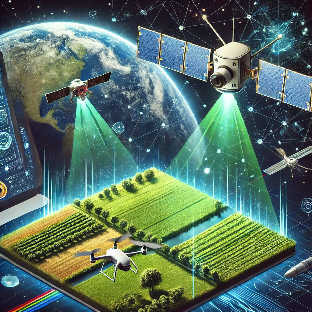
Remote sensing is a powerful technology that enables the acquisition of information about objects or areas from a distance, typically using satellites, drones, or aircraft-mounted sensors. This method has become an essential tool in various fields, including environmental monitoring, agriculture, disaster management, and urban planning (Lillesand et al., 2015). By capturing and analyzing electromagnetic radiation reflected or emitted from the Earth’s surface, remote sensing provides valuable data for decision-making and research.
The principles of remote sensing are based on the interaction between electromagnetic waves and objects on the Earth’s surface. Different materials reflect and absorb radiation in unique ways, allowing sensors to distinguish between vegetation, water bodies, built-up areas, and other land cover types (Jensen, 2016). Advanced techniques such as multispectral and hyperspectral imaging further enhance the ability to analyze subtle differences in surface characteristics, leading to more accurate and detailed assessments.
As remote sensing technology continues to evolve, its applications are expanding beyond traditional fields. The integration of artificial intelligence (AI), big data analytics, and cloud computing has revolutionized the way remote sensing data is processed and interpreted (Li et al., 2020). This article explores the fundamental principles of remote sensing, the types of sensors and platforms used, and its diverse applications in various sectors.
Principles of Remote Sensing
Remote sensing operates based on the interaction between electromagnetic radiation and objects on the Earth’s surface. The electromagnetic spectrum, which includes visible light, infrared, microwave, and other wavelengths, plays a crucial role in this process (Campbell & Wynne, 2011). Passive remote sensing relies on natural sunlight as the source of radiation, while active remote sensing uses artificial sources such as radar and LiDAR (Light Detection and Ranging) to illuminate targets and measure their reflected signals.
A key principle in remote sensing is spectral reflectance, which describes how different surfaces absorb and reflect energy at specific wavelengths (Richards, 2013). For instance, healthy vegetation absorbs most red and blue light while reflecting green and near-infrared light, making it easily distinguishable in satellite images. Similarly, water bodies absorb most infrared radiation, allowing researchers to map aquatic environments effectively. Understanding these spectral signatures is essential for interpreting remote sensing data accurately.
Types of Remote Sensing Systems
Remote sensing systems can be categorized into passive and active systems based on their source of radiation. Passive remote sensing depends on external energy sources, such as the Sun, and includes optical and thermal imaging sensors. Examples include multispectral sensors like Landsat and Sentinel satellites, which capture data in multiple wavelengths to analyze land cover, vegetation health, and atmospheric conditions (Pettorelli, 2013).
Active remote sensing, on the other hand, generates its own energy to illuminate targets. LiDAR and Synthetic Aperture Radar (SAR) are common active remote sensing technologies. LiDAR uses laser pulses to create high-resolution 3D models of terrain and objects, making it invaluable for forestry, topographic mapping, and urban planning (Shan & Toth, 2018). SAR, which operates in microwave frequencies, can penetrate clouds and is widely used for monitoring natural disasters, such as floods and landslides (Woodhouse, 2017).
Applications of Remote Sensing
Remote sensing has a wide range of applications across various disciplines. In environmental monitoring, it is used to track deforestation, assess water quality, and monitor climate change (Turner et al., 2015). Satellites equipped with hyperspectral sensors can detect pollutants in water bodies, while thermal imaging can identify temperature variations in the atmosphere and ocean currents, providing critical insights for climate studies.
In agriculture, remote sensing is a key tool for precision farming, enabling farmers to monitor crop health, soil moisture levels, and pest infestations (Mulla, 2013). By analyzing vegetation indices such as the Normalized Difference Vegetation Index (NDVI), farmers can optimize irrigation schedules, improve yield predictions, and reduce resource wastage. The integration of remote sensing with IoT-based sensors further enhances its effectiveness in modern farming practices.
Data Processing and Interpretation in Remote Sensing
The process of converting raw remote sensing data into meaningful information involves several steps, including preprocessing, classification, and analysis. Preprocessing includes radiometric and geometric corrections to eliminate distortions caused by atmospheric conditions and sensor limitations (Richards, 2013). Image enhancement techniques, such as contrast stretching and filtering, improve visual clarity for interpretation.
Classification methods play a crucial role in extracting useful information from remote sensing images. Supervised classification relies on training datasets where known land cover types are used to guide the algorithm in categorizing other pixels. Meanwhile, unsupervised classification clusters pixels based on spectral similarity without prior knowledge. Machine learning and deep learning models are increasingly used to automate and improve classification accuracy.
Challenges in Remote Sensing
Despite its advantages, remote sensing faces several challenges, including data limitations, atmospheric interference, and high costs. Some remote sensing platforms have limited temporal resolution, meaning they cannot capture frequent changes in rapidly evolving environments (Lillesand et al., 2015). Cloud cover can obstruct optical sensors, reducing the effectiveness of passive remote sensing in tropical regions.
Another challenge is the complexity of data processing and interpretation. Large volumes of remote sensing data require powerful computing resources and expertise in geospatial analysis. While AI and cloud computing are helping to address this issue, accessibility remains a challenge for smaller institutions and developing countries. Additionally, the cost of high-resolution imagery and advanced sensors can be prohibitive, limiting widespread adoption.
Ethical and Legal Considerations in Remote Sensing
As remote sensing technology advances, ethical and legal considerations are becoming more prominent. Privacy concerns arise with high-resolution satellite imagery, particularly in urban areas where individuals and private properties can be identified (Georgiadou, 2020). Regulations governing data usage and distribution vary across countries, raising questions about ownership and accessibility.
The use of remote sensing in defense and surveillance also raises ethical concerns. Governments and organizations must balance national security interests with the rights to privacy and transparency. Additionally, the potential misuse of remote sensing for unauthorized activities, such as resource exploitation and environmental violations, necessitates robust policies and international cooperation to ensure responsible usage.
Conclusion
Remote sensing is a transformative technology that has reshaped how we observe and analyze our planet. The ability to capture data from a distance without direct contact makes remote sensing an indispensable tool in modern science and industry.
As technology continues to advance, the integration of artificial intelligence, cloud computing, and real-time analytics will further enhance the capabilities of remote sensing. These innovations will play a vital role in tackling global challenges such as climate change, food security, and sustainable urban development.
In the coming years, remote sensing will remain at the forefront of geospatial technology, driving data-driven decision-making and fostering scientific discoveries.
References
- Batty, M. (2018). Inventing Future Cities. MIT Press.
- Campbell, J. B., & Wynne, R. H. (2011). Introduction to Remote Sensing (5th ed.). Guilford Press.
- Georgiadou, Y. (2020). Geo-information Ethics and Privacy. Springer.
- Jensen, J. R. (2016). Introductory Digital Image Processing: A Remote Sensing Perspective (4th ed.). Pearson.
- Li, X., Cheng, T., & Wang, S. (2020). Artificial Intelligence in Remote Sensing. Springer.
- Lillesand, T., Kiefer, R. W., & Chipman, J. (2015). Remote Sensing and Image Interpretation (7th ed.). Wiley.
- Mulla, D. J. (2013). Twenty-five years of remote sensing in precision agriculture: Key advances and remaining knowledge gaps. Biosystems Engineering, 114(4), 358-371.
- Pettorelli, N. (2013). Satellite Remote Sensing for Ecology. Cambridge University Press.
- Richards, J. A. (2013). Remote Sensing Digital Image Analysis: An Introduction. Springer.
- Shan, J., & Toth, C. K. (2018). Topographic Laser Ranging and Scanning: Principles and Processing. CRC Press.
- Turner, W., Spector, S., Gardiner, N., Fladeland, M., Sterling, E., & Steininger, M. (2015). Remote sensing for biodiversity science and conservation. Trends in Ecology & Evolution, 18(6), 306-314.
- Woodhouse, I. H. (2017). Introduction to Microwave Remote Sensing. CRC Press.


Leave a Reply
Want to join the discussion?Feel free to contribute!