SAR (Synthetic Aperture Radar): Principles and Use Cases in Remote Sensing
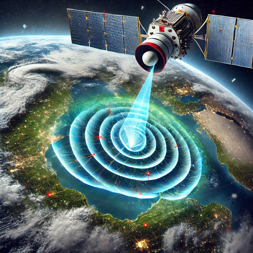
Synthetic Aperture Radar (SAR) is an advanced remote sensing technology that uses radar waves to generate high-resolution images of the Earth’s surface. Unlike optical sensors, SAR operates in the microwave spectrum, allowing it to penetrate clouds, fog, and even some vegetation, making it highly effective for all-weather and day-and-night observations (Henderson & Lewis, 1998).
SAR technology has become an essential tool in environmental monitoring, disaster management, agriculture, and defense applications. Its ability to capture detailed surface information, regardless of atmospheric conditions, makes it superior to many traditional imaging techniques in challenging environments (Woodhouse, 2017).
Principles of SAR Technology
How SAR Works
SAR systems transmit microwave pulses toward the Earth’s surface and record the reflected signals, known as backscatter. By using the motion of the platform (satellite, aircraft, or drone), SAR synthesizes a large antenna aperture, significantly improving spatial resolution compared to conventional radar (Curlander & McDonough, 1991).
SAR images are generated based on the time delay and intensity of the returned signals. Different surface materials, such as water, vegetation, and urban structures, reflect radar waves uniquely, enabling detailed classification of land cover types (Richards, 2009).
SAR Wavelengths and Bands
SAR systems operate in different microwave bands, each suited for specific applications:
- X-band (8-12 GHz): Provides high-resolution images, commonly used for urban mapping and infrastructure monitoring (Rosen et al., 2000).
- C-band (4-8 GHz): Used in Sentinel-1 and RADARSAT missions for agricultural monitoring and disaster response (Henderson & Lewis, 1998).
- L-band (1-2 GHz): Penetrates vegetation and is widely used for forestry, biomass estimation, and geological studies (Simard et al., 2012).
- P-band (<1 GHz): Capable of penetrating deeper into forest canopies and soil, used in research applications for subsurface mapping (Ho Tong Minh et al., 2014).
Use Cases of SAR in Remote Sensing
Disaster Management and Environmental Monitoring
One of the most critical applications of SAR is disaster monitoring, particularly in flood mapping, earthquake damage assessment, and landslide detection. Since SAR can penetrate cloud cover, it is extensively used to track floods and assess damage in real time (Schumann & Moller, 2015).
SAR interferometry (InSAR) is widely employed in earthquake and volcano monitoring. By comparing SAR images taken at different times, InSAR can detect subtle ground deformations, enabling scientists to predict seismic activity and assess volcanic hazards (Massonnet & Feigl, 1998).
Agriculture and Soil Moisture Monitoring
SAR plays a significant role in agricultural monitoring by detecting crop health, soil moisture levels, and land-use changes. C-band SAR sensors, such as those on the Sentinel-1 satellites, are particularly effective in tracking crop growth stages and assessing drought impacts (McNairn et al., 2002).
L-band SAR is commonly used for estimating soil moisture levels, which are crucial for water resource management and climate modeling. By analyzing SAR backscatter, researchers can assess soil conditions even in areas with persistent cloud cover (Zribi et al., 2011).
Forestry and Biomass Estimation
L-band and P-band SAR are widely used for forest monitoring, particularly for estimating biomass and detecting deforestation. The ability of longer wavelengths to penetrate vegetation allows SAR to measure tree height, canopy structure, and forest density (Simard et al., 2012).
SAR-based forest monitoring is crucial for carbon accounting and climate change studies. Missions like ALOS PALSAR and NASA’s upcoming NISAR are designed to provide global forest biomass measurements to support environmental conservation efforts (Shimada et al., 2014).
Infrastructure Monitoring and Urban Mapping
SAR is extensively used in infrastructure monitoring, particularly for detecting land subsidence, construction activities, and structural deformations. Interferometric SAR (InSAR) can measure millimeter-scale displacements in buildings, bridges, and roads, making it invaluable for engineering assessments and disaster prevention (Ferretti et al., 2001).
Urban planners and governments use SAR to map city expansions, monitor illegal construction, and assess changes in land use. High-resolution X-band SAR, such as TerraSAR-X and COSMO-SkyMed, provides detailed urban imagery for planning and development purposes (Gamba & Dell’Acqua, 2009).
Challenges in SAR Remote Sensing
Data Processing and Interpretation
One of the biggest challenges in SAR remote sensing is data processing. Unlike optical images, SAR data requires complex processing techniques, including speckle filtering, geometric correction, and radiometric calibration (Moreira et al., 2013).
The interpretation of SAR imagery can also be difficult, as the radar backscatter varies depending on surface roughness, dielectric properties, and viewing geometry. Machine learning and AI-driven SAR analysis are being developed to improve classification accuracy and automate feature extraction (Zhu et al., 2017).
Cost and Accessibility
While SAR technology offers significant advantages, the cost of acquiring high-resolution SAR imagery remains a challenge. Commercial SAR satellites, such as ICEYE and Capella Space, provide high-quality data but require paid access, limiting availability for research and non-commercial users (Gorelick et al., 2017).
Open-access SAR datasets, such as those from Sentinel-1, have improved accessibility, but their resolution may not be sufficient for all applications. The increasing number of small SAR satellite constellations is expected to reduce costs and enhance global SAR coverage in the future (Krieger et al., 2020).
Future Trends in SAR Technology
AI and Cloud-Based SAR Processing
The integration of AI and cloud computing is revolutionizing SAR data analysis. Machine learning algorithms can enhance image classification, automate change detection, and improve disaster response efficiency (Zhu et al., 2017).
Cloud platforms such as Google Earth Engine and AWS SAR processing services are making SAR data more accessible, enabling real-time analysis for researchers and decision-makers (Gorelick et al., 2017).
Miniaturized SAR Satellites and Constellations
The development of small SAR satellites is rapidly expanding global monitoring capabilities. Companies like ICEYE and Capella Space are deploying microsatellite constellations to provide high-frequency SAR observations, improving coverage for environmental monitoring, defense, and commercial applications (Krieger et al., 2020).
Future SAR missions, such as NASA-ISRO’s NISAR, aim to provide global high-resolution SAR data for forest monitoring, agriculture, and natural hazard assessment. These advancements will further enhance the role of SAR in remote sensing applications (Shimada et al., 2014).
Conclusion
Synthetic Aperture Radar (SAR) is a versatile and powerful remote sensing technology that provides high-resolution imaging capabilities regardless of weather or lighting conditions. From disaster monitoring to precision agriculture, SAR plays a crucial role in geospatial analysis and decision-making.
Despite challenges related to data processing and cost, advancements in AI, cloud computing, and small SAR satellites are making SAR technology more accessible and efficient. As these innovations continue, SAR is expected to play an even greater role in global environmental monitoring, infrastructure management, and defense applications.
Reference:
- Curlander, J. C., & McDonough, R. N. (1991). Synthetic Aperture Radar: Systems and Signal Processing. Wiley.
- Ferretti, A., Prati, C., & Rocca, F. (2001). Permanent scatterers in SAR interferometry. IEEE Transactions on Geoscience and Remote Sensing, 39(1), 8-20.
- Gamba, P., & Dell’Acqua, F. (2009). Per city remote sensing: From multispectral to SAR data. IEEE Journal of Selected Topics in Applied Earth Observations and Remote Sensing, 2(2), 85-92.
- Gorelick, N., Hancher, M., Dixon, M., Ilyushchenko, S., Thau, D., & Moore, R. (2017). Google Earth Engine: Planetary-scale geospatial analysis for everyone. Remote Sensing of Environment, 202, 18-27.
- Henderson, F. M., & Lewis, A. J. (1998). Principles and Applications of Imaging Radar. Wiley.
- Ho Tong Minh, D., Nicolas, J. M., Rudant, J. P., Dubois-Fernandez, P. C., & Belhadj, S. (2014). P-band SAR interferometry for biomass estimation: Influence of temporal decorrelation. IEEE Transactions on Geoscience and Remote Sensing, 52(7), 4038-4050.
- Krieger, G., Moreira, A., Fiedler, H., Hajnsek, I., Werner, M., Younis, M., & Zink, M. (2020). TanDEM-X: A satellite formation for high-resolution SAR interferometry. IEEE Transactions on Geoscience and Remote Sensing, 45(11), 3317-3341.
- Massonnet, D., & Feigl, K. L. (1998). Radar interferometry and its application to changes in the Earth’s surface. Reviews of Geophysics, 36(4), 441-500.
- McNairn, H., Champagne, C., Shang, J., Holmstrom, D., & Reichert, G. (2002). Integration of SAR and optical imagery for monitoring agricultural crops. Canadian Journal of Remote Sensing, 35(3), 225-236.
- Moreira, A., Prats-Iraola, P., Younis, M., Krieger, G., Hajnsek, I., & Papathanassiou, K. P. (2013). A tutorial on synthetic aperture radar. IEEE Geoscience and Remote Sensing Magazine, 1(1), 6-43.
- Richards, J. A. (2009). Remote Sensing with Imaging Radar. Springer.
- Rosen, P. A., Hensley, S., Joughin, I. R., Li, F. K., Madsen, S. N., Rodriguez, E., & Goldstein, R. M. (2000). Synthetic aperture radar interferometry. Proceedings of the IEEE, 88(3), 333-382.
- Schumann, G., & Moller, D. (2015). Synthetic aperture radar flood mapping: A review. Remote Sensing, 7(7), 8828-8852.
- Shimada, M., Itoh, T., Motooka, T., Watanabe, M., Shiraishi, T., Thapa, R., & Lucas, R. (2014). New global forest/non-forest maps from ALOS PALSAR data. Remote Sensing of Environment, 155, 13-31.
- Simard, M., Pinto, N., Fisher, J. B., & Baccini, A. (2012). Mapping forest canopy height globally with spaceborne lidar. Journal of Geophysical Research: Biogeosciences, 116(G4), G00E07.
- Woodhouse, I. H. (2017). Introduction to Microwave Remote Sensing. CRC Press.
- Zribi, M., Baghdadi, N., Holah, N., & Fafin, O. (2011). New methodology for soil moisture estimation and its application to ENVISAT-ASAR multi-incidence data inversion. Remote Sensing of Environment, 112(5), 1210-1221.
- Zhu, X. X., Tuia, D., Mou, L., Xia, G. S., Zhang, L., Xu, F., & Fraundorfer, F. (2017). Deep learning in remote sensing: A comprehensive review and list of resources. IEEE Geoscience and Remote Sensing Magazine, 5(4), 8-36.


Leave a Reply
Want to join the discussion?Feel free to contribute!