Common Remote Sensing Platforms: Satellites, Drones, and Airborne Sensors
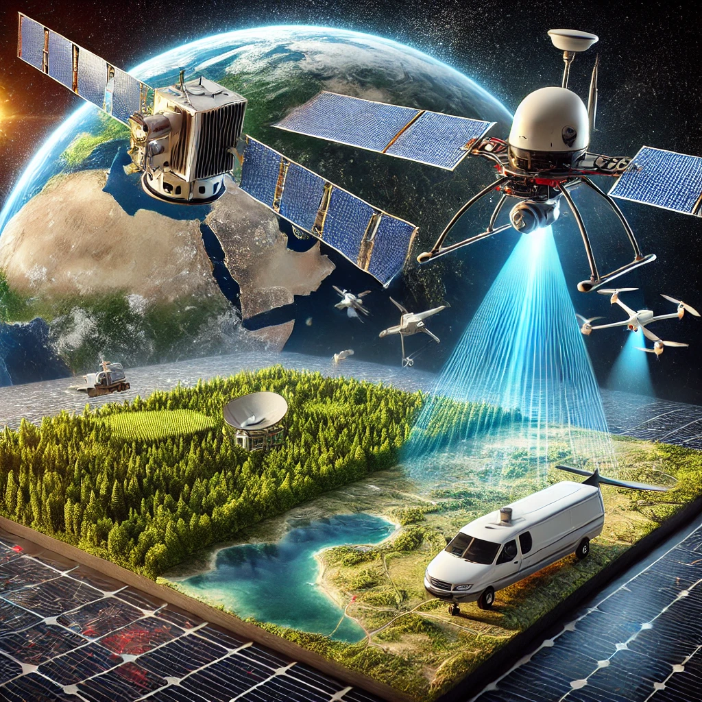
Remote sensing platforms have evolved significantly, offering diverse options for collecting geospatial data across different scales and applications. Among the most commonly used platforms are satellites, drones, and airborne sensors, each with unique advantages and limitations (Jensen, 2007). These technologies support critical applications in environmental monitoring, agriculture, disaster management, and urban planning (Lillesand et al., 2015).
Satellites provide large-scale, long-term data for global and regional monitoring, while drones and airborne sensors offer higher spatial resolution and greater flexibility for local studies (Pettorelli, 2013). Understanding the strengths and limitations of each platform is essential for selecting the most appropriate tool for specific remote sensing applications.
Satellite-Based Remote Sensing
Characteristics and Capabilities
Satellites are among the most widely used remote sensing platforms, offering continuous, large-scale coverage of the Earth’s surface. Equipped with various sensors, including optical, thermal, and radar instruments, satellites capture valuable geospatial data for environmental monitoring, land cover classification, and climate studies (Richards, 2013).
Different types of satellites serve specific purposes. Passive satellites, such as Landsat and Sentinel, rely on sunlight to capture images in the visible and infrared spectrums, making them ideal for vegetation analysis and urban mapping. Active satellites, like Sentinel-1 and RADARSAT, utilize radar systems to penetrate clouds and provide all-weather imaging capabilities (Henderson & Lewis, 1998).
Applications of Satellite Remote Sensing
Satellites play a crucial role in tracking large-scale environmental changes, such as deforestation, glacier retreat, and ocean temperature variations. Multispectral and hyperspectral sensors enable detailed analysis of land cover changes and ecosystem health, supporting sustainable land use planning (Mulla, 2013).
Additionally, satellites contribute to disaster management by providing near-real-time imagery of natural disasters, including hurricanes, wildfires, and floods. The ability to monitor disaster-prone areas remotely helps governments and organizations respond more effectively to emergencies (Gorelick et al., 2017).
Drone-Based Remote Sensing
Advantages and Flexibility
Drones, also known as Unmanned Aerial Vehicles (UAVs), have revolutionized remote sensing by offering high-resolution, customizable data collection at a relatively low cost. Unlike satellites, drones can be deployed on demand, making them ideal for time-sensitive applications such as precision agriculture and infrastructure monitoring (Colomina & Molina, 2014).
Equipped with advanced sensors, including multispectral, thermal, and LiDAR systems, drones can capture fine-scale details that are often missed by satellite imagery. Their ability to fly at low altitudes enables accurate topographic mapping, vegetation analysis, and 3D modeling of urban environments (Zhang & Kovacs, 2012).
Applications of Drone Remote Sensing
Drones are widely used in agriculture for monitoring crop health, detecting pest infestations, and optimizing irrigation strategies. By analyzing vegetation indices such as NDVI, farmers can make data-driven decisions to improve yield and reduce resource wastage (Lobell et al., 2007).
In disaster response, drones provide rapid damage assessments and assist in search and rescue missions by capturing high-resolution imagery in affected areas. Their ability to operate in hazardous conditions makes them an invaluable tool for emergency management (Giordan et al., 2018).
Airborne Remote Sensing
Capabilities and Use Cases
Airborne remote sensing involves sensors mounted on piloted aircraft, offering a balance between the broad coverage of satellites and the high-resolution capabilities of drones. These systems are commonly used for LiDAR surveys, high-resolution aerial photography, and thermal imaging (Baltsavias, 1999).
Compared to satellites, airborne sensors provide more flexible data acquisition and can capture detailed topographic and geospatial information. They are frequently employed in geological mapping, forestry analysis, and urban planning projects (Mancini et al., 2013).
Applications of Airborne Remote Sensing
One of the key applications of airborne remote sensing is in LiDAR-based terrain mapping. LiDAR-equipped aircraft generate high-precision elevation models, which are essential for flood risk assessment, infrastructure development, and archaeological site discovery (Doneus et al., 2013).
Additionally, airborne thermal sensors are used to monitor industrial emissions, assess energy efficiency in buildings, and detect heat anomalies in urban environments. These applications support environmental regulations and sustainable city planning (Weng, 2009).
Future Trends in Remote Sensing Platforms
Integration of AI and Automation
The future of remote sensing platforms is increasingly driven by artificial intelligence (AI) and automation. AI-powered image analysis enhances object detection, land cover classification, and change detection, reducing the need for manual interpretation (Zhu et al., 2017).
Cloud-based platforms, such as Google Earth Engine, facilitate large-scale data processing, enabling researchers to analyze satellite, drone, and airborne imagery more efficiently. These advancements improve decision-making in environmental management and disaster response (Gorelick et al., 2017).
Advancements in Sensor Technology
The continuous improvement of remote sensing sensors is expanding the capabilities of satellites, drones, and airborne systems. Miniaturized hyperspectral sensors are making high-resolution spectral imaging more accessible, while next-generation LiDAR technology enhances precision mapping (Goetz, 2009).
Additionally, the rise of small satellite constellations, such as CubeSats, is increasing the availability of high-resolution, near-real-time imagery. These developments will further enhance the efficiency and accessibility of remote sensing applications worldwide (Hand, 2015).
Conclusion
Satellites, drones, and airborne sensors each offer unique advantages for remote sensing applications. While satellites provide large-scale, long-term data for global monitoring, drones and airborne sensors deliver high-resolution, flexible, and on-demand data collection for local-scale studies.
As sensor technology and AI-driven analytics continue to advance, the integration of these platforms will enhance geospatial intelligence, supporting environmental conservation, disaster management, and urban development. The future of remote sensing lies in leveraging these technologies to improve decision-making and sustainable resource management.
References
- Baltsavias, E. P. (1999). Airborne laser scanning: Basic relations and formulas. ISPRS Journal of Photogrammetry and Remote Sensing, 54(2-3), 199-214.
- Campbell, J. B., & Wynne, R. H. (2011). Introduction to Remote Sensing (5th ed.). Guilford Press.
- Colomina, I., & Molina, P. (2014). Unmanned aerial systems for photogrammetry and remote sensing: A review. ISPRS Journal of Photogrammetry and Remote Sensing, 92, 79-97.
- Doneus, M., Briese, C., Fera, M., & Janner, M. (2013). Archaeological prospection of forested areas using full-waveform airborne laser scanning. Journal of Archaeological Science, 40(2), 406-413.
- Giordan, D., Manconi, A., Facello, A., Baldo, M., Allasia, P., & Dutto, F. (2018). Brief communication: The use of remotely piloted aircraft systems (RPASs) for natural hazards monitoring and management. Natural Hazards and Earth System Sciences, 18(4), 1079-1092.
- Goetz, A. F. H. (2009). Three decades of hyperspectral remote sensing of the Earth: A personal view. Remote Sensing of Environment, 113(S1), S5-S16.
- Gorelick, N., Hancher, M., Dixon, M., Ilyushchenko, S., Thau, D., & Moore, R. (2017). Google Earth Engine: Planetary-scale geospatial analysis for everyone. Remote Sensing of Environment, 202, 18-27.
- Hand, E. (2015). Startup launches fleet of tiny satellites to image Earth every day. Science, 348(6235), 172-173.
- Henderson, F. M., & Lewis, A. J. (1998). Principles and Applications of Imaging Radar. Wiley.
- Jensen, J. R. (2007). Remote Sensing of the Environment: An Earth Resource Perspective (2nd ed.). Pearson.
- Lillesand, T., Kiefer, R. W., & Chipman, J. (2015). Remote Sensing and Image Interpretation (7th ed.). Wiley.
- Lobell, D. B., Asner, G. P., Ortiz-Monasterio, J. I., & Benning, T. L. (2007). Remote sensing of regional crop production in the Yaqui Valley, Mexico: Estimates and uncertainties. Agricultural and Forest Meteorology, 139(3-4), 121-132.
- Mancini, F., Dubbini, M., Gattelli, M., Stecchi, F., Fabbri, S., & Gabbianelli, G. (2013). Using unmanned aerial vehicles (UAV) for high-resolution reconstruction of topography: The structure from motion approach on coastal environments. Remote Sensing, 5(12), 6880-6898.
- Mulla, D. J. (2013). Twenty-five years of remote sensing in precision agriculture: Key advances and remaining knowledge gaps. Biosystems Engineering, 114(4), 358-371.
- Pettorelli, N. (2013). Satellite Remote Sensing for Ecology. Cambridge University Press.
- Richards, J. A. (2013). Remote Sensing Digital Image Analysis: An Introduction. Springer.
- Weng, Q. (2009). Thermal infrared remote sensing for urban climate and environmental studies: Methods, applications, and trends. ISPRS Journal of Photogrammetry and Remote Sensing, 64(4), 335-344.
- Zhang, C., & Kovacs, J. M. (2012). The application of small unmanned aerial systems for precision agriculture: A review. Precision Agriculture, 13(6), 693-712.
- Zhu, X. X., Tuia, D., Mou, L., Xia, G. S., Zhang, L., Xu, F., & Fraundorfer, F. (2017). Deep learning in remote sensing: A comprehensive review and list of resources. IEEE Geoscience and Remote Sensing Magazine, 5(4), 8-36.


Leave a Reply
Want to join the discussion?Feel free to contribute!