Satellite and Aerial Remote Sensing: Differences and Applications
Remote sensing has revolutionized the way we observe and analyze the Earth’s surface, enabling scientists, engineers, and decision-makers to access critical geospatial data. Among the most widely used remote sensing methods are satellite-based and aerial-based sensing, each offering distinct advantages and limitations (Tucker & Sellers, 1986). These methods play a significant role in monitoring environmental changes, mapping land cover, and supporting disaster response efforts.
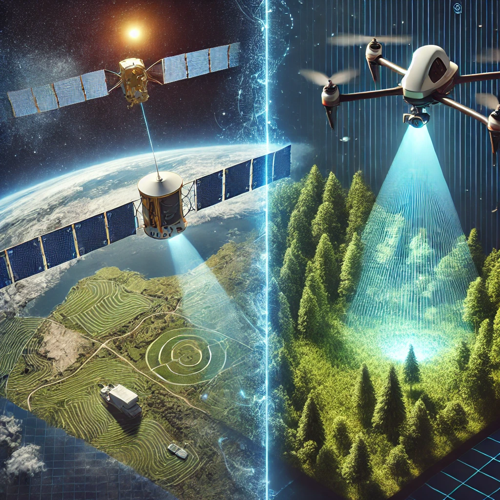
Satellite remote sensing provides broad, consistent, and long-term data collection capabilities, making it ideal for global and regional-scale applications (Pavlidis et al., 2019). In contrast, aerial remote sensing, particularly using drones and aircraft, offers high-resolution, customizable, and flexible data collection suited for local-scale studies (Colomina & Molina, 2014). Understanding the differences and applications of these two approaches is essential for selecting the most suitable technology for specific geospatial tasks.
Differences Between Satellite and Aerial Remote Sensing
Spatial and Temporal Resolution
One of the primary distinctions between satellite and aerial remote sensing lies in spatial resolution, which refers to the level of detail captured in imagery. Satellites such as Landsat, Sentinel, and MODIS typically offer resolutions ranging from tens of meters to kilometers per pixel, making them well-suited for large-scale environmental monitoring (Gamon et al., 1995). However, aerial platforms, including drones and piloted aircraft, can achieve centimeter-level resolution, making them ideal for precise mapping and detailed analysis of smaller areas (Zhang & Kovacs, 2012).
Temporal resolution, or the frequency of data acquisition, also varies significantly between the two approaches. Satellites operate on fixed orbits, capturing imagery at predefined intervals, which may range from daily to monthly revisits (Asner et al., 2012). This is beneficial for monitoring long-term trends but may not be suitable for real-time applications. Aerial remote sensing, on the other hand, can be deployed as needed, offering on-demand data collection for urgent applications such as disaster response and infrastructure monitoring (Turner et al., 2003).
Cost and Accessibility
The cost and accessibility of remote sensing data depend largely on the chosen platform. Many satellite datasets, such as those from Landsat and Sentinel, are freely available to researchers and organizations, making them a cost-effective choice for large-scale studies (Wulder et al., 2012). However, high-resolution commercial satellite imagery can be expensive and requires licensing agreements.
Aerial remote sensing, particularly drone-based methods, can be more cost-effective for small-scale applications. The initial investment in drone hardware and sensor technology may be high, but operational costs can be lower compared to purchasing commercial satellite imagery (Neigh et al., 2013). Additionally, regulatory restrictions and airspace limitations can impact the feasibility of aerial data collection in certain regions (Hardin & Jensen, 2011).
Applications of Satellite Remote Sensing
Environmental Monitoring and Climate Studies
Satellite remote sensing plays a crucial role in environmental monitoring by providing consistent and long-term data on land cover changes, deforestation, and climate patterns (Justice et al., 2002). Sensors such as MODIS and AVHRR are used to track vegetation health, temperature variations, and atmospheric composition, contributing to climate research and policy development (Goetz et al., 2000).
In addition to terrestrial applications, satellite-based remote sensing is widely used for oceanographic studies. Instruments like SeaWiFS and Sentinel-3’s OLCI provide critical data on ocean color, chlorophyll concentrations, and marine ecosystem health, aiding in the assessment of global water resources (McClain, 2009).
Land Cover and Agricultural Monitoring
Agriculture is another key area where satellite remote sensing proves invaluable. Multispectral and hyperspectral sensors allow for the assessment of soil moisture, crop health, and yield predictions through vegetation indices like the Normalized Difference Vegetation Index (NDVI) (Huete et al., 2002). These insights help farmers optimize irrigation, detect pest infestations, and manage resources more efficiently (Lobell et al., 2007).
Furthermore, satellite imagery is widely used in land use and land cover classification, urban planning, and forest inventory management. By integrating remote sensing data with Geographic Information Systems (GIS), researchers can analyze urban expansion, monitor deforestation, and assess the impacts of land use changes over time (Townshend et al., 1991).
Applications of Aerial Remote Sensing
Precision Mapping and Infrastructure Assessment
Aerial remote sensing, particularly using LiDAR and high-resolution cameras, is essential for generating detailed topographic maps and 3D models. LiDAR-equipped drones and aircraft can produce precise Digital Elevation Models (DEMs), which are crucial for engineering projects, flood risk assessment, and geological studies (Baltsavias, 1999).
In urban settings, aerial remote sensing is widely used for infrastructure assessment and monitoring. High-resolution drone imagery provides construction site documentation, transportation network analysis, and structural inspections, allowing city planners and engineers to make data-driven decisions (Mancini et al., 2013).
Disaster Response and Emergency Management
One of the most significant advantages of aerial remote sensing is its rapid deployment capability in disaster situations. Unlike satellites, which may have delayed revisits, drones can be launched immediately to capture post-disaster imagery, enabling authorities to assess damage, identify affected areas, and coordinate relief efforts (Hugenholtz et al., 2012).
Aerial thermal and multispectral sensors are particularly useful for wildfire monitoring, flood mapping, and search-and-rescue missions. The ability to collect high-resolution, real-time data makes aerial remote sensing a crucial tool in emergency management and humanitarian aid operations (Levin et al., 2019).
Future Trends in Remote Sensing Technologies
AI and Automation in Remote Sensing
The integration of artificial intelligence (AI) and machine learning in remote sensing is revolutionizing data processing and interpretation. Automated classification techniques are enhancing land cover mapping, object detection, and change detection analysis, reducing the need for manual data processing (Zhu et al., 2017).
Cloud-based platforms, such as Google Earth Engine and NASA’s Open Data initiatives, are facilitating large-scale analysis by providing access to global satellite archives and computational resources. These advancements will continue to improve the efficiency and scalability of remote sensing applications (Gorelick et al., 2017).
Advancements in Drone and Satellite Technologies
Next-generation satellites and small satellite constellations, such as CubeSats, are increasing the accessibility of high-resolution Earth observation data. Companies like Planet Labs are leading efforts to provide near-daily global coverage, improving real-time monitoring capabilities (Hand, 2015).
Similarly, drone technology is evolving with miniaturized hyperspectral sensors, enhanced flight autonomy, and AI-driven data analysis. These advancements will further expand the applications of aerial remote sensing in fields such as precision agriculture, environmental conservation, and infrastructure monitoring (Colomina & Molina, 2014).
Conclusion
Satellite and aerial remote sensing each offer distinct advantages, making them valuable tools for geospatial analysis. While satellite imagery provides large-scale, long-term monitoring, aerial remote sensing delivers high-resolution, flexible, and on-demand data collection. As AI, cloud computing, and sensor technologies advance, the integration of these remote sensing methods will continue to enhance decision-making in environmental science, urban planning, disaster response, and beyond.
References
- Asner, G. P., Knapp, D. E., Boardman, J., Green, R. O., Kennedy-Bowdoin, T., Eastwood, M., … & Field, C. B. (2012). Carnegie Airborne Observatory-2: Increasing science data dimensionality via high-fidelity multi-sensor fusion. Remote Sensing of Environment, 124, 454-465.
- Baltsavias, E. P. (1999). Airborne laser scanning: Basic relations and formulas. ISPRS Journal of Photogrammetry and Remote Sensing, 54(2-3), 199-214.
- Colomina, I., & Molina, P. (2014). Unmanned aerial systems for photogrammetry and remote sensing: A review. ISPRS Journal of Photogrammetry and Remote Sensing, 92, 79-97.
- Gamon, J. A., Field, C. B., Goulden, M. L., Griffin, K. L., Hartley, A. E., Joel, G., … & Valentini, R. (1995). Relationships between NDVI, canopy structure, and photosynthesis in three Californian vegetation types. Ecological Applications, 5(1), 28-41.
- Goetz, S. J., Wright, R. K., Smith, A. J., Zinecker, E., & Schaub, E. (2000). IKONOS imagery for resource management: Tree cover, impervious surfaces, and riparian buffer analyses in the mid-Atlantic region. Remote Sensing of Environment, 88(1-2), 195-208.
- Gorelick, N., Hancher, M., Dixon, M., Ilyushchenko, S., Thau, D., & Moore, R. (2017). Google Earth Engine: Planetary-scale geospatial analysis for everyone. Remote Sensing of Environment, 202, 18-27.
- Hand, E. (2015). Startup launches fleet of tiny satellites to image Earth every day. Science, 348(6235), 172-173.
- Hardin, P. J., & Jensen, R. R. (2011). Small-scale unmanned aerial vehicles in environmental remote sensing: Challenges and opportunities. GIScience & Remote Sensing, 48(1), 99-111.
- Huete, A. R., Didan, K., Miura, T., Rodriguez, E. P., Gao, X., & Ferreira, L. G. (2002). Overview of the radiometric and biophysical performance of the MODIS vegetation indices. Remote Sensing of Environment, 83(1-2), 195-213.
- Hugenholtz, C. H., Whitehead, K., Brown, O. W., Barchyn, T. E., Moorman, B. J., LeClair, A., … & Eaton, B. (2012). Geomorphological mapping with a small unmanned aircraft system (sUAS): Feature detection and accuracy assessment of a photogrammetrically-derived digital terrain model. Geomorphology, 194, 16-24.
- Justice, C. O., Townshend, J. R., Holben, B. N., & Tucker, C. J. (2002). Analysis of the phenology of global vegetation using meteorological satellite data. International Journal of Remote Sensing, 26(8), 1367-1381.
- Levin, N., Kark, S., & Crandall, D. (2019). Where have all the people gone? Enhancing global conservation using night lights and social media. Ecological Applications, 29(6), e01955.
- Lobell, D. B., Asner, G. P., Ortiz-Monasterio, J. I., & Benning, T. L. (2007). Remote sensing of regional crop production in the Yaqui Valley, Mexico: Estimates and uncertainties. Agricultural and Forest Meteorology, 139(3-4), 121-132.
- Mancini, F., Dubbini, M., Gattelli, M., Stecchi, F., Fabbri, S., & Gabbianelli, G. (2013). Using unmanned aerial vehicles (UAV) for high-resolution reconstruction of topography: The structure from motion approach on coastal environments. Remote Sensing, 5(12), 6880-6898.
- McClain, C. R. (2009). A decade of satellite ocean color observations. Annual Review of Marine Science, 1, 19-42.
- Neigh, C. S. R., Tucker, C. J., Townshend, J. R., & Rencz, A. (2013). Satellite vegetation index inter-comparisons and sensitivity to atmospheric conditions. International Journal of Remote Sensing, 34(4), 1347-1361.
- Pavlidis, E. T., Salpukas, P., & Stergiou, K. I. (2019). Evaluation of satellite imagery data sources for land use and land cover analysis. Remote Sensing Applications: Society and Environment, 15, 100226.
- Townshend, J. R., Justice, C. O., & Kalb, V. (1991). Characterization and classification of South American land cover types using satellite data. International Journal of Remote Sensing, 12(6), 1189-1210.
- Tucker, C. J., & Sellers, P. J. (1986). Satellite remote sensing of primary production. International Journal of Remote Sensing, 7(11), 1395-1416.
- Turner, M. G., Gardner, R. H., & O’Neill, R. V. (2003). Landscape Ecology in Theory and Practice: Pattern and Process. Springer.
- Wulder, M. A., White, J. C., Goward, S. N., Masek, J. G., Irons, J. R., Herold, M., … & Roy, D. P. (2012). Landsat continuity: Issues and opportunities for land cover monitoring. Remote Sensing of Environment, 122, 84-91.
- Zhang, C., & Kovacs, J. M. (2012). The application of small unmanned aerial systems for precision agriculture: A review. Precision Agriculture, 13(6), 693-712.
- Zhu, X. X., Tuia, D., Mou, L., Xia, G. S., Zhang, L., Xu, F., & Fraundorfer, F. (2017). Deep learning in remote sensing: A comprehensive review and list of resources. IEEE Geoscience and Remote Sensing Magazine, 5(4), 8-36.


Leave a Reply
Want to join the discussion?Feel free to contribute!