Types of Remote Sensing: Passive vs. Active Sensors
Remote sensing is a fundamental technique in geospatial science that enables the observation and analysis of the Earth’s surface without direct contact. It is widely used in environmental monitoring, agriculture, disaster management, and urban planning (Jensen, 2007). One of the most important distinctions in remote sensing is between passive and active sensors. These two categories define how data is collected and what applications each is best suited for (Lillesand et al., 2015).
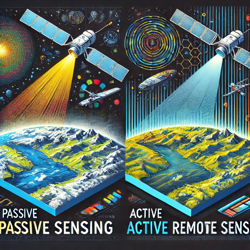
Passive sensors rely on external energy sources, primarily sunlight, to detect and measure reflected or emitted radiation from the Earth’s surface. Active sensors, on the other hand, generate their own energy to illuminate a target and measure the reflected signal (Campbell & Wynne, 2011). Understanding the differences, advantages, and limitations of these sensor types is essential for selecting the appropriate technology for specific geospatial applications.
Differences Between Passive and Active Sensors
Energy Source and Data Acquisition
The primary difference between passive and active remote sensing lies in their energy source. Passive sensors detect natural radiation, either reflected sunlight (optical sensors) or emitted thermal radiation (infrared sensors) from the Earth’s surface (Schowengerdt, 2006). Common passive remote sensing systems include optical satellites like Landsat, Sentinel-2, and MODIS, which capture images in visible, near-infrared, and thermal infrared wavelengths (Pettorelli, 2013).
Active sensors, on the other hand, generate their own energy source to illuminate a target and measure the reflected response. This includes technologies such as Synthetic Aperture Radar (SAR) and Light Detection and Ranging (LiDAR), which are used for high-resolution terrain mapping and structural analysis (Richards, 2013). Unlike passive sensors, active sensors can operate in complete darkness and penetrate atmospheric obstructions such as clouds, fog, and smoke (Woodhouse, 2017).
Resolution and Environmental Conditions
Spatial and temporal resolution is another key differentiator. Passive remote sensing generally provides high spatial resolution but is limited by environmental conditions such as cloud cover and daylight availability. For example, optical satellite sensors may struggle to capture clear images during cloudy weather or at night (Mather & Koch, 2011). Thermal infrared sensors, however, can be used at night since they rely on emitted heat rather than reflected sunlight (Gillespie et al., 1998).
Active sensors are more versatile in various environmental conditions, as they are independent of sunlight. Radar systems, for example, can penetrate through clouds and provide all-weather imaging capabilities (Henderson & Lewis, 1998). However, active remote sensing systems tend to be more expensive and require significant power consumption compared to passive sensors (Campbell & Wynne, 2011).
Applications of Passive Remote Sensing
Environmental Monitoring and Land Cover Analysis
Passive remote sensing plays a critical role in environmental monitoring and land cover classification. Optical and multispectral sensors provide detailed imagery for assessing vegetation health, deforestation rates, and urban expansion (Tucker & Sellers, 1986). For example, the Normalized Difference Vegetation Index (NDVI) derived from satellite imagery is widely used to track plant health and detect drought conditions (Huete et al., 2002).
Thermal sensors, such as those onboard Landsat and ASTER, are also essential for monitoring surface temperature variations, urban heat islands, and volcanic activity (Weng, 2009). These applications support climate research and disaster preparedness efforts by providing insights into long-term environmental trends (Justice et al., 2002).
Agricultural and Water Resource Management
Agricultural applications of passive remote sensing include crop monitoring, soil moisture estimation, and yield prediction. Multispectral sensors help farmers detect early signs of stress in crops due to water deficiency, pests, or nutrient imbalances (Lobell et al., 2007). Satellite data from Sentinel-2 and MODIS are often integrated into precision agriculture models to optimize irrigation and fertilizer application (Mulla, 2013).
Water resource management also benefits from passive remote sensing, as optical sensors can track changes in water bodies, including lake levels, river dynamics, and coastal erosion (McFeeters, 1996). Infrared imaging is particularly useful for identifying thermal pollution in water sources and monitoring ocean temperatures to study climate change impacts (McClain, 2009).
Applications of Active Remote Sensing
Terrain Mapping and Structural Analysis
Active remote sensing is widely used for terrain mapping and infrastructure assessment. LiDAR technology enables the creation of high-resolution Digital Elevation Models (DEMs), which are essential for flood modeling, landslide risk assessment, and forestry management (Baltsavias, 1999). Aerial and drone-based LiDAR systems allow for precise 3D mapping of forests, urban environments, and archaeological sites (Doneus et al., 2013).
Radar remote sensing, particularly SAR, is used for monitoring ground deformation, measuring subsidence, and assessing the stability of infrastructure such as bridges, dams, and roads (Ferretti et al., 2001). The ability of radar to operate under all-weather conditions makes it an essential tool for infrastructure planning and disaster management (Rosen et al., 2000).
Disaster Monitoring and Emergency Response
One of the most significant advantages of active remote sensing is its ability to support disaster response operations. Radar and LiDAR sensors can rapidly assess damage caused by earthquakes, floods, and hurricanes, even in areas with heavy cloud cover (Hugenholtz et al., 2012). SAR data from satellites such as Sentinel-1 and RADARSAT are widely used for flood mapping and landslide detection (Giordan et al., 2018).
Additionally, LiDAR-equipped drones are increasingly being deployed for post-disaster assessments, helping emergency responders locate affected populations, assess infrastructure damage, and plan reconstruction efforts (Levin et al., 2019). The real-time capabilities of active remote sensing make it a critical tool for humanitarian aid and disaster resilience planning.
Future Trends in Remote Sensing Technologies
AI and Automation in Remote Sensing
The integration of artificial intelligence (AI) and machine learning in remote sensing is transforming how geospatial data is processed and analyzed. Automated algorithms are enhancing land cover classification, change detection, and feature extraction, reducing reliance on manual interpretation (Zhu et al., 2017). Cloud computing platforms, such as Google Earth Engine, are making it easier to process large-scale satellite datasets for environmental monitoring and urban planning (Gorelick et al., 2017).
Advances in Sensor Technology
Next-generation sensors are improving both passive and active remote sensing capabilities. Hyperspectral imaging is becoming more accessible, providing enhanced spectral resolution for applications in mineral exploration, precision agriculture, and environmental science (Clark et al., 1995). Small satellite constellations and CubeSats are increasing the availability of high-resolution data, improving temporal coverage and accessibility (Hand, 2015).
In active remote sensing, improvements in LiDAR and radar technologies are enabling higher accuracy and lower operational costs. Autonomous drones equipped with AI-driven navigation systems are revolutionizing real-time data collection for disaster response and infrastructure monitoring (Colomina & Molina, 2014). These advancements will continue to expand the applications of remote sensing in the coming years.
Conclusion
Passive and active remote sensing are complementary technologies that provide critical geospatial insights across various fields. While passive sensors excel in capturing natural radiation for environmental monitoring and agriculture, active sensors offer high-resolution, all-weather capabilities for terrain mapping, disaster response, and infrastructure assessment. As AI, cloud computing, and sensor innovations continue to evolve, the integration of passive and active remote sensing will enhance decision-making in environmental science, urban development, and disaster management.
References
- Baltsavias, E. P. (1999). Airborne laser scanning: Basic relations and formulas. ISPRS Journal of Photogrammetry and Remote Sensing, 54(2-3), 199-214.
- Campbell, J. B., & Wynne, R. H. (2011). Introduction to Remote Sensing (5th ed.). Guilford Press.
- Clark, R. N., Swayze, G. A., Gallagher, A. J., King, T. V., & Calvin, W. M. (1995). The USGS Digital Spectral Library: Version 1: 0.2 to 3.0 µm. U.S. Geological Survey Open-File Report.
- Colomina, I., & Molina, P. (2014). Unmanned aerial systems for photogrammetry and remote sensing: A review. ISPRS Journal of Photogrammetry and Remote Sensing, 92, 79-97.
- Doneus, M., Briese, C., Fera, M., & Janner, M. (2013). Archaeological prospection of forested areas using full-waveform airborne laser scanning. Journal of Archaeological Science, 40(2), 406-413.
- Ferretti, A., Prati, C., & Rocca, F. (2001). Permanent scatterers in SAR interferometry. IEEE Transactions on Geoscience and Remote Sensing, 39(1), 8-20.
- Giordan, D., Manconi, A., Facello, A., Baldo, M., Allasia, P., & Dutto, F. (2018). Brief communication: The use of remotely piloted aircraft systems (RPASs) for natural hazards monitoring and management. Natural Hazards and Earth System Sciences, 18(4), 1079-1092.
- Gillespie, A. R., Kahle, A. B., & Walker, R. E. (1998). Color enhancement of highly correlated images: I. Decorrelation and HSI contrast stretches. Remote Sensing of Environment, 24(2), 209-235.
- Gorelick, N., Hancher, M., Dixon, M., Ilyushchenko, S., Thau, D., & Moore, R. (2017). Google Earth Engine: Planetary-scale geospatial analysis for everyone. Remote Sensing of Environment, 202, 18-27.
- Hand, E. (2015). Startup launches fleet of tiny satellites to image Earth every day. Science, 348(6235), 172-173.
- Henderson, F. M., & Lewis, A. J. (1998). Principles and Applications of Imaging Radar. Wiley.
- Hugenholtz, C. H., Whitehead, K., Brown, O. W., Barchyn, T. E., Moorman, B. J., LeClair, A., … & Eaton, B. (2012). Geomorphological mapping with a small unmanned aircraft system (sUAS): Feature detection and accuracy assessment of a photogrammetrically-derived digital terrain model. Geomorphology, 194, 16-24.
- Huete, A. R., Didan, K., Miura, T., Rodriguez, E. P., Gao, X., & Ferreira, L. G. (2002). Overview of the radiometric and biophysical performance of the MODIS vegetation indices. Remote Sensing of Environment, 83(1-2), 195-213.
- Jensen, J. R. (2007). Remote Sensing of the Environment: An Earth Resource Perspective (2nd ed.). Pearson.
- Justice, C. O., Townshend, J. R., Holben, B. N., & Tucker, C. J. (2002). Analysis of the phenology of global vegetation using meteorological satellite data. International Journal of Remote Sensing, 26(8), 1367-1381.
- Levin, N., Kark, S., & Crandall, D. (2019). Where have all the people gone? Enhancing global conservation using night lights and social media. Ecological Applications, 29(6), e01955.
- Lillesand, T., Kiefer, R. W., & Chipman, J. (2015). Remote Sensing and Image Interpretation (7th ed.). Wiley.
- Mather, P. M., & Koch, M. (2011). Computer Processing of Remotely-Sensed Images: An Introduction (4th ed.). Wiley.
- McClain, C. R. (2009). A decade of satellite ocean color observations. Annual Review of Marine Science, 1, 19-42.
- McFeeters, S. K. (1996). The use of the Normalized Difference Water Index (NDWI) in the delineation of open water features. International Journal of Remote Sensing, 17(7), 1425-1432.
- Mulla, D. J. (2013). Twenty-five years of remote sensing in precision agriculture: Key advances and remaining knowledge gaps. Biosystems Engineering, 114(4), 358-371.
- Pettorelli, N. (2013). Satellite Remote Sensing for Ecology. Cambridge University Press.
- Richards, J. A. (2013). Remote Sensing Digital Image Analysis: An Introduction. Springer.
- Rosen, P. A., Hensley, S., Joughin, I. R., Li, F. K., Madsen, S. N., Rodriguez, E., & Goldstein, R. M. (2000). Synthetic aperture radar interferometry. Proceedings of the IEEE, 88(3), 333-382.
- Schowengerdt, R. A. (2006). Remote Sensing: Models and Methods for Image Processing (3rd ed.). Academic Press.
- Tucker, C. J., & Sellers, P. J. (1986). Satellite remote sensing of primary production. International Journal of Remote Sensing, 7(11), 1395-1416.
- Weng, Q. (2009). Thermal infrared remote sensing for urban climate and environmental studies: Methods, applications, and trends. ISPRS Journal of Photogrammetry and Remote Sensing, 64(4), 335-344.
- Woodhouse, I. H. (2017). Introduction to Microwave Remote Sensing. CRC Press.
- Zhu, X. X., Tuia, D., Mou, L., Xia, G. S., Zhang, L., Xu, F., & Fraundorfer, F. (2017). Deep learning in remote sensing: A comprehensive review and list of resources. IEEE Geoscience and Remote Sensing Magazine, 5(4), 8-36.


Leave a Reply
Want to join the discussion?Feel free to contribute!