A clear image is a starting observation, not a restoration verdict
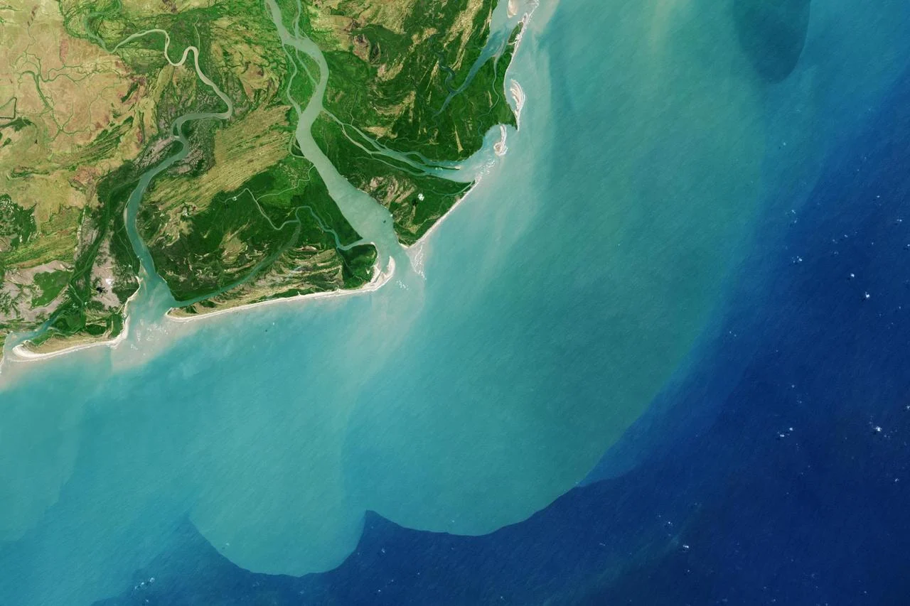
An abandoned coastal pond may look dry and accessible in one satellite image and extensively flooded in another. Those views are useful for planning a mangrove restoration baseline, but their difference is not automatically degradation or recovery. The acquisition times may sample different tidal states, and the pond interior may drain differently from the adjacent creek. A baseline should preserve what each image actually observed while organizing the additional field evidence needed to understand the local water regime.
This guide focuses on that observation design before an intervention is selected. It separates landscape history, water visibility, local inundation and ecological response instead of reducing them to one restoration-suitability color. The examples are conceptual; no real pond, restoration result or engineering option is assessed. A practical output is a shared map and evidence register that helps a remote-sensing analyst, field ecologist and site manager ask compatible questions about the same places and dates.
Use regional mangrove history as context with a named version
An extent time series can identify historical mangrove patterns around a candidate site and help frame questions about neighboring stands or former land cover. The Global Mangrove Watch version-three record documents a historical series spanning 1996 to 2020. That is a useful example of a versioned regional context layer, not an instruction to treat its endpoint as today's condition. Its record now points readers toward a newer release, so a new project should check current documentation and retain the release it actually uses.
A regional extent label does not explain why a particular pond lacks trees, whether land access is available or whether its hydrology supports regeneration. Do not transform an old non-mangrove cell into an automatic planting opportunity. Review recent observations, local land history and the project's ecological objectives before drawing the assessment boundary. Preserve the original extent layer separately from your interpretation, including the dates and any uncertainties that matter near fragmented edges or small embankments. [1]
Build a tidal observation register for the imagery
For every selected image, record acquisition time with its time standard, usable site coverage, sensor, processing level and the visible water pattern. Add available tide information with its location and vertical reference, while distinguishing a prediction from a local measurement. Grouping observations by comparable tidal context can make before-and-after comparisons more interpretable. Keep rainfall, intervention dates and other relevant site records nearby so a different water pattern is not attributed to a restoration action solely because the image was acquired later.
The purpose is not to force every scene into a universal high-or-low category. A coastal tide station can help organize observation timing without describing every interior pond. If its connection to the site is uncertain, label that uncertainty rather than transfer a water level as though it were measured inside the assessment area. An image with an unclear tide context may still show canopy or channel geometry; simply avoid asking it to establish a local flooding duration that the observation cannot resolve.
Inspect drainage compartments rather than one site-wide tide label
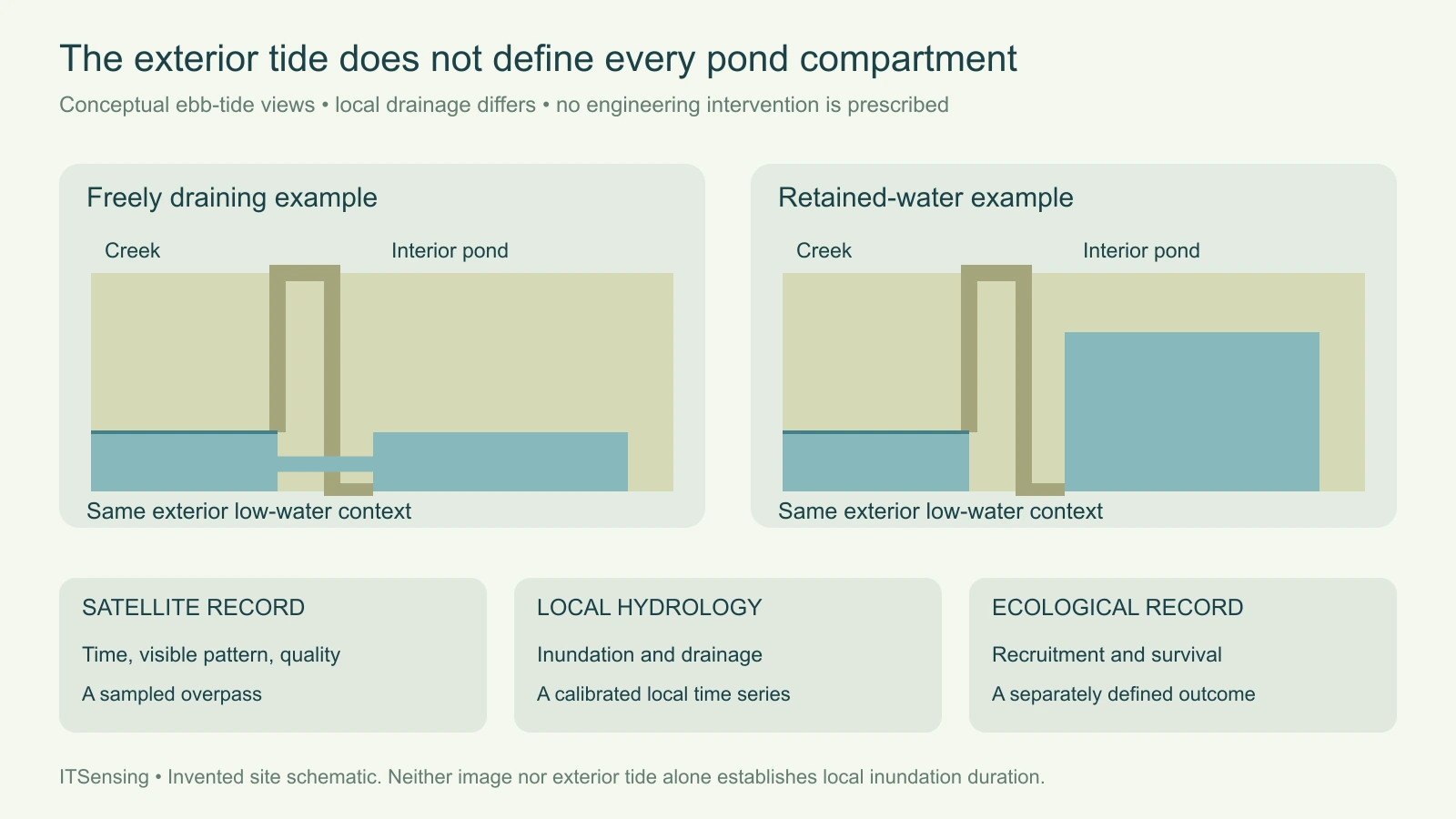
Consider an invented pond with a narrow outlet and a partly intact embankment. At an ebb-tide overpass, the creek outside may have a low water level while water remains in a poorly drained interior compartment. Another compartment can be exposed at the same time. A single exterior tide label would hide that contrast. Draw candidate compartments and visible connections as hypotheses to inspect, keeping the imagery date attached to each observation rather than merging them into a timeless hydrological map.
Van Loon and colleagues' hydrological-classification study found that nearby open-water levels or tidal information alone were insufficient to characterize their restoration sites. It also describes spatial variation associated with small topographic differences, dikes and levees. This supports a site-specific measurement plan, not a universal rule that every pond behaves identically. Satellite views can help locate where to investigate a blocked or delayed connection, while local records are needed to evaluate how long inundation persists within those compartments. [2]
Combine overpass snapshots with local time series
Repeated water detections in clear satellite observations describe the sampled overpasses under a detection policy. Their proportion is not automatically the fraction of all clock time that the ground was flooded. Cloud exclusions, acquisition timing and gaps can sample the tidal cycle unevenly. Keep a detection count and valid-observation count, and resist relabeling their ratio as inundation duration unless a method explicitly supports that inference. Sparse snapshots and continuous local monitoring answer complementary questions rather than interchangeable ones.
Balke and colleagues demonstrated a calibrated logger-equipped float for monitoring inundation and current-related behavior in coastal wetlands, including a former aquaculture-pond application in North Sumatra. The study illustrates how local time-series observations can address restoration-planning questions beyond a satellite snapshot. It does not make an uncalibrated instrument reading self-explanatory or establish a universal deployment design. Select and check field methods against the desired quantity, document their local support, and use them to test the compartment hypotheses identified from the imagery. [3]
Keep hydrological change separate from ecological recovery
A new water connection, a change in exposed sediment and an increase in visible canopy are different observations. They may occur at different stages and do not prove the same outcome. Establish indicators for the intervention mechanism and for the ecological objective before monitoring begins. If the project seeks natural regeneration, observations of recruitment and establishment need field definitions and timing appropriate to that goal. A greener pixel is useful evidence to inspect, but it does not by itself identify the species or demonstrate seedling survival.
Reference stands can help interpret local conditions when their ecology and landscape position are relevant, yet their apparent similarity should be checked on the ground. Hydrology is important without being the only influence on vegetation. The hydrological-classification paper also discusses soil and other ecological factors and cautions against rigid interpretation of classes. Avoid turning a map threshold into a planting prescription. Intervention design and species decisions require site assessment and the responsible specialists, with uncertainty retained wherever the baseline has not resolved a necessary condition. [2]
Prepare a baseline that can support later attribution
Deliver compartment identifiers linked to dated imagery, visible channels and embankments, observation-quality masks and field-monitoring locations. Keep tide context, local water records and ecological measurements in separate but joinable tables. State which conclusions are direct observations and which remain hypotheses. Preserve pre-intervention evidence and an appropriate comparison strategy so a later canopy increase is not credited to one action without examining background changes. The baseline is strongest when it allows competing explanations to be checked rather than merely making a persuasive map.
Plan repeat observations around both comparable conditions and the range of conditions the ecological question needs. Revisit unresolved drainage areas instead of hiding them under a single site score. A useful handover can say that historical mangrove context, current channel geometry and local inundation evidence support further investigation in a particular compartment while other prerequisites remain open. That is a meaningful remote-sensing contribution: it directs field effort and preserves an interpretable record, without claiming that an attractive low-tide image has already demonstrated successful restoration.