Give the survey a question the imagery can help answer
A rehabilitation map becomes more useful when its uncertain patches turn into specific observation requests. A satellite time series might show persistent exposed ground on one bench, increasing vegetation response on another and an abrupt departure near a drainage line. Sending a drone to photograph the whole site without those questions can produce an attractive mosaic while leaving the original uncertainty unresolved. Begin by describing what needs to be distinguished at each mapped location and which evidence could distinguish it.
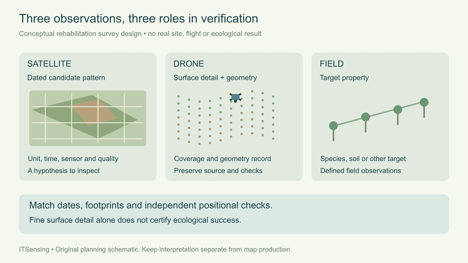
This guide develops a survey brief that connects satellite observations, drone surface detail and independent field records. It concerns verification of mapped patterns and their interpretation, not certification of mine closure or the design of earthworks. The hypothetical landscape is invented. The intended result is a practical handover: a survey team can see where the satellite evidence is strong, where it is incomplete, and what additional observations would change the assessment of each rehabilitation unit.
1. Separate the surface pattern from the rehabilitation conclusion
Define the satellite finding in observable terms, such as a repeated vegetation-index increase or a classified patch of exposed material. Keep treatment dates, seed mixes and maintenance records as separate attributes. A positive vegetation response does not by itself identify the desired species or establish soil condition. An apparent decline can reflect a change in observation conditions as well as a change on the ground. The survey should test those competing interpretations rather than inherit the map's color as its conclusion.
A NASA DEVELOP feasibility study of Pennsylvania reclamation explicitly reported limitations from differing green-up timing and cautioned that observed vegetation changes could not be attributed solely to reclamation work. That local study is useful methodological context, not a transferable performance guarantee. For your own site, preserve the actual source acquisitions and seasonal context beside the candidate survey locations. A vegetation map assembled from different stages of green-up can otherwise send the field team to investigate an apparent rehabilitation problem created partly by timing. [1]
2. Design coverage around both representative and unusual areas
Organize candidate areas by the questions they raise: stable cover, persistent bare ground, recent change, shadowed terrain and uncertain boundaries may deserve different observations. Include ordinary conditions as well as conspicuous anomalies so the team can compare what a typical mapped unit looks like at finer scale. Attach a reason for visiting each location and identify the spatial footprint that its observations are intended to represent. Keep inaccessible or unobserved locations in the register instead of quietly removing them.
A targeted inspection and a statistical accuracy assessment are different designs. Selecting the most suspicious patches can help diagnose failure modes, but their observed error frequency does not automatically estimate map-wide accuracy. If the project also needs a defensible population estimate, define that sampling design and its inclusion probabilities separately. Do not let a convenient flight corridor silently become the reference sample for the entire mine. The brief should say which question each set of observations is meant to support.
3. Specify surface products by what they represent
An orthomosaic can reveal spatial detail in visible cover, channels and exposed surfaces; a photogrammetric surface model supplies a different representation of geometry. The National Park Service's UAS methods brief describes deriving three-dimensional geometry from overlapping images and producing orthorectified mosaics and elevation models. Those methods provide useful context for choosing deliverables, without implying that a particular mine surface will reconstruct completely or that every visible plant can be identified from an aerial view.
State whether the requested elevation product represents the visible surface or an independently justified ground surface. Vegetation and reconstruction gaps matter when the question concerns drainage or terrain change. Likewise, an RGB drone camera does not supply the near-infrared band needed to recreate a satellite NDVI measurement. Choose imagery and field measurements appropriate to the target, and ask for source coverage and quality information alongside the final product. A finer output grid should not be mistaken for a statement of verified accuracy. [2]
4. Keep positional evidence independent of visual agreement
USGS guidance emphasizes that ground-control accuracy and tie-point quality contribute to UAS geometric accuracy regardless of image ground sample distance. Its publication summary also stresses common units and calibration metadata. In a survey brief, therefore, request a documented coordinate reference, vertical reference where relevant, control information and a separate account of validation. A small pixel size describes sampling; it does not demonstrate that a feature is located correctly in the satellite comparison.
Reserve independent reference observations for checking the delivered geometry rather than evaluating it only at points used to fit the reconstruction. Inspect stable, identifiable features across the useful survey extent, and retain their residuals and reference quality. Specify the project's needed measurement support instead of copying an arbitrary accuracy target or control-point count from another application. If the geometry is not adequate near a rehabilitation boundary, record the resulting uncertainty in the comparison rather than adjusting the boundary until the layers look convincing. [3]
5. Match survey timing and reporting support
Plan the drone acquisition and field visit close enough to the satellite observation for the target condition to remain interpretable. Record any intervening grading, rainfall, maintenance or seasonal change. A drone survey can accurately describe today's surface while failing to explain a satellite anomaly from a different site state. Keep dated photographs, observation notes and treatment records linked to location identifiers so later analysts can distinguish a timing mismatch from a classification or registration problem.
Translate fine observations back to the reporting unit deliberately. One satellite footprint can contain planted rows, bare strips and drainage features visible separately in a drone mosaic. Summarize the relevant fine-scale evidence over the declared footprint, retaining unobserved portions and edge uncertainty. Do not compare a satellite pixel average with the most favorable small patch inside it. Species composition, survival, soil properties and water chemistry may require field methods beyond what either optical image directly measures.
6. Make the processing handover explicit
For a cloud-photogrammetry workflow such as DroneCollab, define the requested map products and their evidence requirements before processing. Its public site describes orthomosaics, point clouds and elevation outputs; the survey brief still needs acquisition dates, coordinate references, coverage limits and independent quality checks. Keep the original imagery and positioning context traceable to each delivered layer. Choosing a processing platform does not determine whether the observations are suitable for the ecological question or establish a mine-specific outcome.
Package the handover around stable unit identifiers and clear questions rather than a folder of unexplained images. Include the satellite finding, survey footprint, requested surface observations, required field records and the criteria for resolving the uncertainty. Preserve processing and interpretation as separate stages. When a result remains inconclusive, state which missing evidence would help: an obscured surface, uncertain alignment or unresolved species observation should not all receive the same generic low-confidence label.
7. Report findings at the level the evidence supports
The final comparison should connect each conclusion to its observation chain. A persistent satellite anomaly may be explained by bare inter-row strips visible in the drone mosaic, while a field record supplies information about the planted vegetation. Another unit may remain unresolved because its surface was hidden or changed between dates. Retain those distinctions in the GIS attributes and supporting notes. A survey is useful when it sharpens the explanation, even if it does not turn every candidate patch into a definitive result.
Use the combined record to prioritize the next monitoring step and revise the mapping method where evidence warrants it. Keep assessment criteria for rehabilitation outcomes explicit and under the responsible site's evaluation process. Satellite archives provide landscape history, drone products add targeted surface detail, and field observations address properties the imagery does not measure directly. A well-designed brief connects those strengths while preserving their limits, giving the next team a reproducible basis for investigation instead of an attractive but unsupported verdict.
Sources and technical reading
- [1] Widas et al. (2024), NASA DEVELOP Pennsylvania reclamation feasibility study: methodology and errors/uncertainties
- [2] National Park Service, Preservation Matters: Small Unmanned Aerial Systems, data collection and visualization
- [3] USGS, Guidelines for calibration of uncrewed aircraft systems imagery: official publication summary